
THE OREGON TRAIL
IN THE SADDLE ON THE LATEST BACKCOUNTRY DISCOVERY ROUTE
PHOTOS BY ELI WOODY AND WORDS BY NATHAN FANT
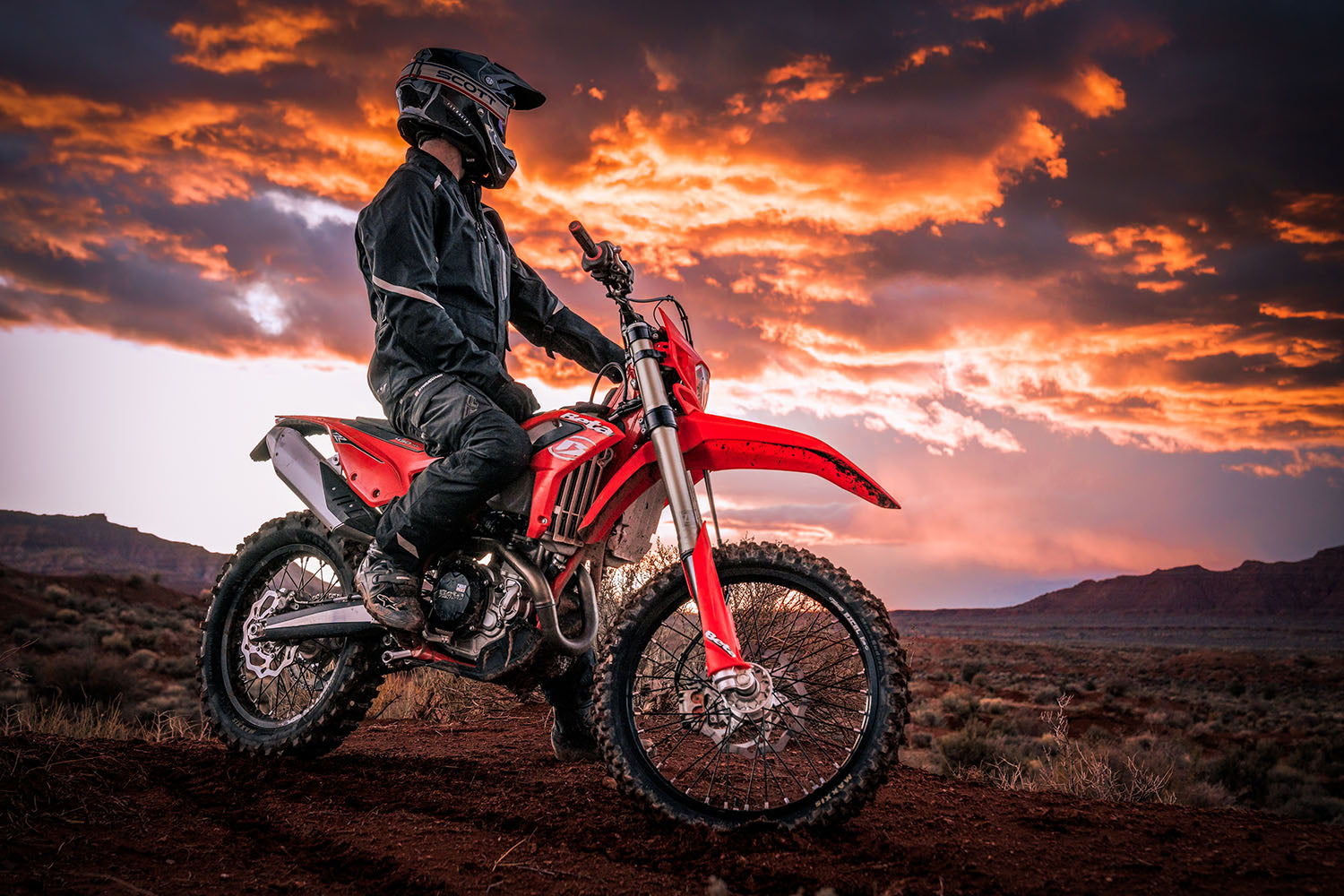
As I slide my foot forward to drop the kickstand and turn off the sound of my idling engine, I am surrounded by a scene from another century. The rocky canyons in front of me open up to a limitless view of the horizon, with untouched desert in all directions. The only sound I hear is the gentle breeze of the wind; it carries with it the slight scent of sagebrush. I am stopped at a little oasis in the desert, a rocky canyon along the Oregon BDR that feels like the place a cowboy would have stopped at while driving cattle through this region 150 years earlier. A spring feeds a pool from which cows stop to drink. Following the sounds of water trickling down the sides of the rocky canyon walls, I hike up to the source to fill my bladder with the most refreshing spring water. Our Oregon BDR Expedition Team is deep in the heart of the vastly unpopulated area in southeast Oregon, on the newly released Oregon Backcountry Discovery Route.


THE ORBDR ROUTE
One of the most anticipated BDR routes, the Oregon BDR is 700 miles from start to finish and is divided into 7 sections, ranging from as little as 63 miles up to 150 miles between fuel stops. The route starts in the tiny, one-store town of Denio Junction, NV, and ends in the beautiful rolling hills of Hood River, Oregon at the Columbia River. After nearly five years of scouting work, not only is the Oregon Route finally here to satisfy the itch of every two wheeled adventure traveler, it is magnificent in its portrayal of natural beauty and diversity of terrain that Oregon offers. Beginning with high desert open sagebrush land in the south, the route traverses Ponderosa Pine forests with extensive lava rock formations in central Oregon, and ends in the Cascade mountain range, with its beautiful Douglas Fir forests, volcano peaks, rivers, and lakes on the northern border. While the world may picture Oregon as a lush, green rainforest, when you ride this route, you’ll experience diversity beyond your wildest imagination.


SECTION 1: DENIO JUNCTION TO PLUSH
The word that comes to mind for Section 1 is remote. Standing atop Beatys Butte, there is a 360 degree view of land as far as the eye can see. As we rode through this high desert terrain, our contact with civilization was limited to remote cattle ranches. The route follows wide open desert two-track roads that become fairly rocky and challenging at times. Later in the riding season, as temperatures heat up and precipitation becomes rare, roads can become more sandy with loose silt beds that nearly swallow your front tire. Caution is the best practice but for the confident rider, this type of challenge is one that is welcome.


The route in this section takes you farther away from civilization than most BDRs. This is the longest section between fuel stops, at about 150 miles. Lodging is rustic and will need to be booked well in advance, so plan accordingly. Dispersed camping is widely available and intensely beautiful. We camped at Hart Mountain Hot Springs the first night and enjoyed a relaxing soak in the springs before bed. A much needed bit of rejuvenation for the challenge of Fandango Canyon ahead.

SECTION 2: PLUSH TO CHRISTMAS VALLEY
Section 2 starts in the small town of Plush, Oregon that got its name from a local card game played in the 1800’s during which the town was a hub for cattle and sheep ranchers. Leaving town, the roads quickly change from paved, to a wide gravel road, to a rough and narrow two-track that requires a choice between the high line or the low line on each side of the track. Before long, you’ll be traveling through undeveloped roads of the Coyote Hills and down into Rabbit Canyon, then alongside the seasonal Lake Abert. This section can be especially sandy and rocky at times the further north you get on Sheep Rock Road and Fandango Canyon. The area was once the bottom of a sea bed which left behind large areas of sand deposits. Those sand sections are accompanied by ever more challenging rocky sections, and by the time you get to Fandango, you’ll be in some of the most challenging rocky terrain on the main route. You’ll know you’re through the worst of it as you begin your descent into Christmas Valley.


SECTION 3: CHRISTMAS VALLEY TO SUNRIVER
Our stay at the Lakeside Motel was a welcome rest from the previous day’s rocky, hot, desert punishment. The many, many rocks we bounced over led to not only the previous days trailside flat repair, but a badly damaged front tire to change this morning before starting the day. Tire repairs complete, we made our way north, and were grateful for some time to relax a little and enjoy the scenery. Just outside of Christmas Valley, we stopped at Crack in the Ground, an aptly named land feature that includes a short hike in an interesting two-mile-long, 70-foot-deep crack in the earth. Just past that, Green Mountain offers a stunning 360 degree view of the surrounding area and also offers a great spot to camp.

Landscapes change as you leave Christmas Valley, offering up fragrant Juniper trees, giant Ponderosa Pines, and red volcanic gravel roads. We found ourselves soaking up the quintessential Central Oregon adventure riding with all of its high desert sights and smells. This section has more than a few barbed wire fences. The rule is to leave it how you found it.
There are two optional side trips in Section 3, but both are worth visiting if you’ve got the time. For star gazers or those looking for a great campsite, the Pine Mountain Observatory is a worthwhile stop, with views of the local landscape and OHV trails for miles. Newberry National Volcanic Monument is a delightful side trip with two sparkling lakes that fill the caldera left by ancient volcanic activity. These pristine lakes are home to both camping and cabins.
Dropping into Sunriver involves one of the most fun sections of dirt on the route. This section includes banked turns and roads that are textured to entertain adventure riders! This section was nicknamed “The Luge” by the film team as it reminded us of a bobsled run for your motorcycle! So fun!

SECTION 4: SUNRIVER TO SISTERS
As I emerge from my tent on the 4th day of the Oregon BDR filming expedition, I am greeted by the soothing sound of the Deschutes River as it meanders by our campsite. Day 4 is about when I start to feel in the BDR groove, when I can completely focus on enjoying the experience and living in the moment.
This is the shortest section of the route at 63 miles, but what it lacks in distance it more than makes up for in beauty and fun riding challenges, especially the optional harder section up to the top of Three Creek Butte with snow-peaked volcanoes visible in every direction!


It wasn’t long before we were in prime recreation territory for the nearby town of Bend. Watch for hikers and bicyclists in this area, and don’t forget to ride respectfully!
The town of Sisters is named after the nearby Three Sisters Mountains. It is a western theme town with great food, some cute lodging options, and a chance to stop by a motorcycle shop to buy a tube if you need one... you probably do after all of the rocky fun you’ve been having!

SECTION 5: SISTERS TO DETROIT
At this point in the route, there is another sense of transition, similar to the turning point from vast open high desert in Sections 1 & 2. I felt the Cascades calling me home the further north into Section 5 we went. Stopping at Skylight Cave, we ventured into a cavern that once contained an underground lava flow with rooftop vents to allow columns of heavenly light to illuminate your stay.
Mountains mean something out west. Views of the snow-peaked, craggy, towering giants in all directions atop Cache Mountain, an optional harder section that challenges you with a little of everything (deep sand, rocky step-ups, and deep loose volcanic rocks), reminds you of what the Oregon BDR has been hinting at the whole time. Volcanoes are the true rulers of this land, as also evidenced by the caves, hot springs, and volcanic rocks all around you. A spectacular view that was worth all of the challenge it took to get there.
The Santiam OHV area adds a fun bit of sandy whoops to the mix, which we quite enjoyed! The majority of primitive roads in this area are lined with black, volcanic sand. When wet, this sand is hero dirt. When it’s dry, it can be challenging and deep.

SECTION 6: DETROIT TO GOVERNMENT CAMP
The story of Detroit Oregon is one of adversity, survival, and rebirth as the town was hit by one of Oregon’s most devastating wildfires of 2020. The town and surrounding forest is still in the process of rebuilding and will be for many years. Some parts of Section 6 will remain closed for at least a few years as wildfire reclamation efforts are underway.


One of the best parts about the BDR organization is the positive economic impact riders can have on small towns who have fallen on hard times. As you pass through the town of Detroit, consider getting supplies there. If we all do our part, dollars spent will really make a difference in the future of this fantastic little town along the Oregon BDR!
As we rode deeper into the dense forest canopy, shade was a big shift from our initial days in the wide open desert with its intense sun. This forest also gave us our first opportunity to ride in mud. It was deep, wide, tire swallowing mud in puddles long enough to make you stop and wonder if you’ll have the momentum and nerve to get through.


SECTION 7: GOVERNMENT CAMP TO HOOD RIVER
Section 7 starts with your first up close look at the tallest mountain in Oregon. At over 11,000 feet, Mt. Hood dominates the skyline. A stop at the White River Sno-Park gives you a chance to appreciate this towering behemoth and all of its snow-capped beauty.
Barlow Wagon Road, a road emigrants traveled in the mid 1800’s, delights the imagination with an opportunity to ride on the historic Oregon Trail. Riding respectfully on these historic roads gave us a chance to slow down and hear the echoes of folks nearing the end of their journey, and to see Oregon through their eyes.
Bennett Pass Road, built in the 1930’s as a way to access the High Prairie Forest Service Guard Station, is narrow, rocky and built into the side of a cliff. Your attention will constantly be torn between the technical riding, the breathtaking views of Mt. Hood, and the lush forest around you.
With Mt. Hood in your rearview and Mt. Adams in front of you, you’ll descend into Hood River, ending at the mighty Columbia River. The northern end of the Oregon BDR sends you off with one last reminder of the intense natural beauty the Pacific Northwest displays for all of us to preserve and protect. After all, preserving our privilege to ride motorcycles in the backcountry is the primary goal of the BDR.
This story was originally published in Issue 78